
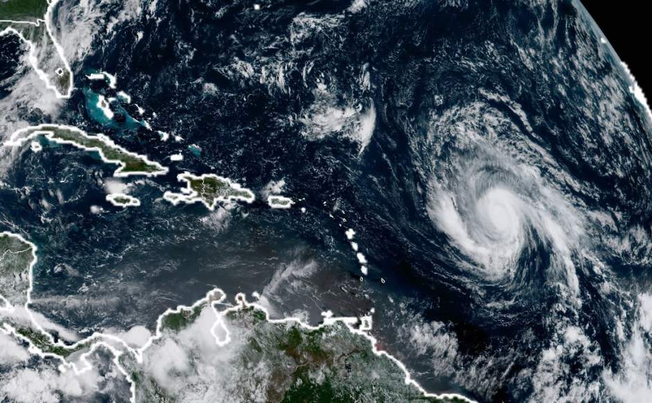
Hurricane Irma regained strength Sunday to a Category 3 storm, with wind at 115 mph and an unpredictable path that might strike the United States next week anywhere between Florida and Nova Scotia.
A sharper image of the hurricane's track should come into focus by Tuesday, said meteorologist Philip Klotzbach with Colorado State University.
The storm could also turn back out to sea without hitting the U.S. mainland.
"The forecast cone is several hundred miles wide, so we'll all be watching, waiting and being prepared," Klotzbach said Sunday. "We don't want the entire coastline from Florida to Maine to freak out, but pay attention."
While Texas and Louisiana dry out from Tropical Storm Harvey's devastating rainfall, the nation is on high alert but needs to be patient, Klotzbach said. He suggested residents on the Eastern Seaboard refresh preparedness kits and keep close watch of the forecasts.
"Subtle shifts in the path now can make big changes as to where it goes next," Klotzbach said. "Follow your local emergency managers and start thinking about what you'd do if there's an order to evacuate or shelter-in-place."
Irma is currently tracking toward the Bahamas by Thursday.
The National Hurricane Center said Sunday that Irma will likely be a major hurricane — meaning a Category 3 or higher — when it moves near the northeastern Leeward Islands by the middle of this week and could cause dangerous wind, storm surge and rainfall.
As the hurricane strengthens over warm water, it could slam into the Caribbean islands as a Category 4 with wind topping 150 mph.
The hurricane center said it is too early to determine what direct impact Irma could have on the U.S. coast by next weekend.
[embed width="350" height="450"] https://twitter.com/weatherchannel/status/904359675453259776 [/embed]